Transitioning from Fall to Winter

Photo credit - Oliver Photo Club

Photo credit – Oliver Photo Club

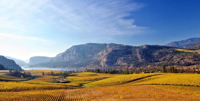
We’re at that point in the seasonal cycle where it could be one or the other. We’re transitioning from fall to winter. Down in the valley it’s still autumn and above freezing, while up in the hills the winter snows are beginning to accumulate. Then, the next day, it’s so warm that you can see the snowline retreating up the hillside. And the day after that, there’s snow on the valley floor, only to be gone before noon. What’s a body to think?

Photo credit - Oliver Photo Club

Photo credit – Oliver Photo Club

I guess a body should just enjoy it. It will be winter soon enough.

rjb

Posted in Uncategorized | 7 Comments

Nacreous

Photo credit - Mark R Schoeberl

Photo credit – Mark R Schoeberl

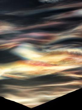
We’ve worked our way from the ground up to the wispy extremes of the high etage (over 20,000 feet.) From the puffy delights of fair weather cumulus all the way up to the enchanting veils of cirrostratus. So where do we go from here? Why, up, of course. Why stop at a mere 20,000 feet when we can carry on up to 50,000, or even 80,000 feet? That’s where today’s cloud, nacreous, lives.

Nacreous clouds are among the most beautiful, being iridescent and highly colorful. Unfortunately, the beauty comes with a barb. Nacreous clouds, also known as polar stratospheric clouds, are composed of nitric acid and sulfuric acid, along with water, and are implicated in depleting the ozone layer.

Photo credit - Martin Machala

Photo credit – Martin Machala

Photo credit - Deven Stross

Photo credit – Deven Stross

Given their composition, nacreous clouds form in the high atmosphere at very cold temperatures – below minus 78 Celsius. The requirement of very low temperature accounts for their prevalence in polar regions. The origin of the name – nacreous – comes from nacre, or mother of pearl, because they share a colorful iridescence.

There is never any precipitation from nacreous clouds.

Photo credit - Deven Stross

Photo credit – Deven Stross

Some of today’s pictures come from the website of Deven Stross, where he has posted some photographs he took in Antarctica. I highly recommend visiting his site.

rjb

Posted in Uncategorized | Tagged , , | 5 Comments

Cirrostratus

Photo credit - David Walker

Photo credit – David Walker

Cloud of the Day – Cirrostratus

The high etage (over 20,000 feet) has a stratiform cloud type, just as the lower two do. Like the other layer clouds, cirrostratus forms in stable air with a high moisture content. Cirrostratus, along with cirrus and cirrocumulus, is often a harbinger of approaching weather. As warm air overtakes and slides up over cold air it creates the formation known as a warm front. The cirrus clouds lead the way at the highest extent of the warm, moist air. As the front approaches, we get progressively lower clouds until the front passes. It will be warmer then, but most likely wetter, too.
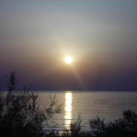
Photo credit - Daniele Massaccesi

Photo credit – Daniele Massaccesi

Photo credit - John Rowlands

Photo credit – John Rowlands

Cirrostratus is made of ice crystals. In addition to washing the color out of the sky, and obscuring the Sun or Moon to varying degrees, the ice crystals can do interesting things to their light. We’ll be looking at that in a later post.

Photo credit - Jane George

Photo credit – Jane George

There is no precipitation from cirrostratus, but it can be an indicator of precipitation to come.

rjb

Posted in Uncategorized | Tagged , , | 3 Comments