Cirrocumulus

Photo credit - King of Hearts CC-BY-SA

Photo credit – King of Hearts CC-BY-SA

Cloud of the Day – Cirrocumulus

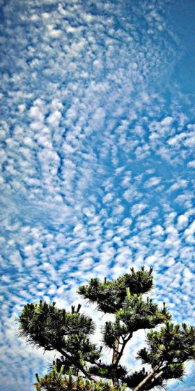
In keeping with stratocumulus and altocumulus in the lower levels, cirrus clouds in the high etage (over 20,000 feet) have a cumuliform species – cirrocumulus. As with the other two, cirrocumulus is formed by convective processes, the vertical development giving the individual cloudlets their heaped appearance. When arranged properly, cirrocumulus takes on the appearance of fish scales, making it the “mackerel scales” in the “Mares’ tails and mackerel scales . . .” proverb. Another arrangement gives the appearance of ripples in the sand.

Photo credit: Dimitry B/Foter/CC-BY
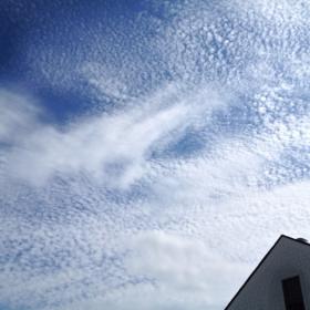
Photo credit: Dimitry B/Foter/CC-BY

Photo credit - © Todd Ellis

Photo credit – © Todd Ellis

It’s often difficult to distinguish between cirrocumulus and altocumulus, with the same cloud formation sometimes being both simultaneously. The only thing setting them apart might be that part of the formation is below 20,000 feet, while the rest is above.

Photo credit: FooNar/Foter/CC-BY

Photo credit: FooNar/Foter/CC-BY

Photo credit: z00mpics/Foter/CC-BY-NC-ND

Photo credit: z00mpics/Foter/CC-BY-NC-ND

Cirrocumulus might contain some super-cooled water droplets, but they’re not very long-lived, soon turning to ice crystals. Cirrocumulus is usually a transition phase between cirrus (mares’ tails) and cirrostratus, as the cloud thickens and the weather system moves in.

Photo credit: LingHK/Foter/CC-BY-NC-SA

Photo credit: LingHK/Foter/CC-BY-NC-SA

Photo credit - NOAA

Photo credit – NOAA

Cirrocumulus might produce some precipitation, but only in the form of virga, which never reaches the ground. It can be an indicator, though, of precipitation to come, as the clouds thicken and lower.

Photo credit - Gerry-Millet

Photo credit – Gerry-Millet

rjb
Posted in Uncategorized | Tagged , | 1 Comment

Four Views

Photo credit - Brian Fry

Photo credit – Brian Fry

Photo credit - Carlos Gaspar

Photo credit – Carlos Gaspar

Photo credit - Jeremy Cook

Photo credit – Jeremy Cook

Photo credit - Bernard Bedard

Photo credit – Bernard Bedard

Posted in Uncategorized | 9 Comments

Cirrus

Photo credit: AGrinberg/Foter/CC BY-NC-ND

Photo credit: AGrinberg/Foter/CC BY-NC-ND

Cloud of the Day – Cirrus

Photo credit - © Andrew Kirk

Photo credit – © Andrew Kirk

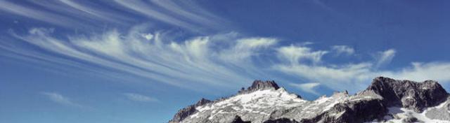
Moving into the high etage, over 20,000 feet, we come to the cirrus clouds. As with the two lower levels, there are a few basic cloud types that exemplify the upper etage. Today we’ll look at the one that is most representative of the type: basic cirrus. Cirrus form the mares’ tails in the old weather adage, “Mares’ tails and mackerel scales make lofty ships carry low sails.” This bit of weather lore is based on the fact that, while these high altitude clouds don’t bring any severe weather themselves, they often presage it. Since the winds are higher up there, the high level clouds precede the body of the weather system.

Photo credit - © Stephen J Gledhill

Photo credit – © Stephen J Gledhill

Cirrus clouds get their name from the Latin, “cirrus,” meaning a curling lock of hair. You can see why, with their wispy appearance. Resembling an artist’s brush strokes, cirrus clouds form from either super-cooled water droplets freezing into ice crystals, or super-cooled water vapor turning directly to ice, bypassing the liquid phase. Almost all cirrus is made of ice crystals, with a few instances of super-cooled water droplets that haven’t yet frozen. The ice crystals’ refractive properties interact with sunlight and moonlight in interesting ways. We’ll cover that in a future post.

Photo credit: NicholasT/Foter/CC BY

Photo credit: NicholasT/Foter/CC BY

Some of the prettiest skies are made by cirrus clouds.

rjb

Posted in Uncategorized | Tagged , | 5 Comments