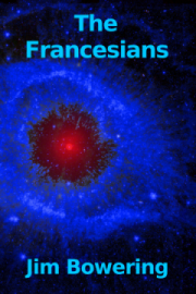
jetstream

All posts tagged jetstream

“Enchanted Light | New Mexico” by Jim Crotty is licensed under CC BY-NC-ND 4.0


Since last time, when the jet stream looped far up to the north of us and the drought level was set at 2, or dry, we have had a series of systems run through here bringing clouds and rain. The jet stream has waved back and forth over our area, channeling that series of storms, and now it has dropped down south of us. The upshot of all that is that we’ve had quite a bit of rain. We might end up recording more than the historical average for September by the time we’re done, although the temperature continues to trend above average. I think it’s safe to extrapolate the drought level, which was still at 2 a couple of weeks ago, to be 1, normal, now.

It’s a relief. Our lawn appreciates it, as do our trees and other plantings. Our forests surely appreciate it, as the wildfire danger rating falls. The fire east of town, as reported in the last drought report, is contained, though still smouldering. I think we can confidently say that the threat of a serious drought has been postponed. The experts still warn, though, that the land is still dry. This recent spate of rain hasn’t done much to change that. Still, the moisture feels good.

rjb

“Enchanted Light | New Mexico” by Jim Crotty is licensed under CC BY-NC-ND 4.0

 
That’s typical. No sooner had I reported on the jet stream being stalled, resulting in cooler, damper weather, than it whipped up north of us putting us in a hotter, drier air mass. As a result the wildfire hazard has spread its extreme rating through more areas in the last week, and a few days ago a fire started just to the east of where I live. In those few days it has grown to more than 1500 hectares. The crews worked hard trying to keep it out of the big timber where it could really take off, but the dry heat and some wind, along with the difficult terrain, have conspired to outrun them.

You can tell where the hills are by the rising sun.

The sound of helicopters and water bombers has been nearly continuous. It’s hard to see the fire in the daytime from here because of the smoke, but at night we can see flames across the hills on the east side of the valley.

With the drying trend I’m surprised that the drought level has stayed at 2 – dry. I was sure I would be reporting a rise to 3 – very dry. I choose to take it as good news. Droughtman has been quiet on the subject. I also take that as good news.

rjb

“Enchanted Light | New Mexico” by Jim Crotty is licensed under CC BY-NC-ND 4.0


Since the last report where the drought level was easing due to low temperatures and wet conditions, things are picking up again. While Droughtman seized the opportunity to point out that the wildfire hazard was low, it didn’t last. We’ve had a few hot, dry days and the scale is back up to very high, just short of an extreme hazard. — Breaking news: it just went up to extreme. — July was the only month to exceed normal during this period when we expect to get a good share of our annual precipitation, and it didn’t even reach 115%.

It looks as if the jet stream might be thinking of moving into its usual summer position, which is well to the north of us. When that happens we settle in for that long period of summer heat that we’ve usually had, or at least begun by now. This year, though, the jet stream seems to have stalled with an arm of it looping down to the west of us. That means there’s an avenue for a series of weather systems to pass nearby or right over us. Hence the lower temperatures and wetter weather.

The fire suppression crews got control of the big fire that was threatening to come over the mountain and descend on us. Those people are champs.

One of these times I’m going to have to talk about the deep duff.

rjb

Credit sleske – CC-BY-SA

Cloud of the Day – Other Phenomena Related to the Jet Stream

As promised in the original post on the jet stream, today’s post will cover related phenomena such as the polar vortex and the Southern Oscillation.

You will recall that jet streams form at the boundaries between major air masses, and at the boundary between the troposphere and the stratosphere. The Polar Jet, for instance, marks the boundary between the colder air mass to the north and the warmer one to the south. As a rule, the greater the difference in temperature of the air masses, the higher the wind speed in the jet stream. The Subtropical Jet is in addition affected by el niño and la niña. which are in turn affected by the Southern Oscillation. Whereas el niño and la niña are ocean events having to do with the warming and cooling of the surface waters of the eastern tropical Pacific Ocean, the Southern Oscillation is an equivalent atmospheric effect. When the two events synchronize they reinforce each other. During an el niño event the subtropical jet stream trends further south, and further north during la niña. When the periodic oscillations of the ocean waters and the atmosphere reinforce each other, the effect on the jet stream is greater and we experience more extreme weather modification. When they tend to cancel each other out, the weather events are less pronounced. This description is vastly simplified and once again I’m impressed by the persistence and attention to detail shown by meteorologists and other scientists.

The polar vortex has made it into the news recently as the eastern part of North America has been subjected to outflows of frigid arctic air. Strangely, people tend to blame the polar vortex, as if its existence were responsible for their frostbitten noses. The fact is, as you will see, it is the polar vortex that normally holds the cold air in, preventing their nasal misery.

Both poles have a polar vortex. They are persistent, large-scale low pressure areas generally lying poleward of sixty degrees latitude. These vortices are upper air phenomena, with their bases in the upper troposhpere and lower stratosphere, around the tropopause, where jet streams live. The strength of the vortex depends on the temperature differential between the equator and the poles. This is greater in winter, which is good for keeping that cold air in and saving our noses.

Unfortunately the vortices are more commonly ill- rather than well-defined. There is not always a strong jet stream wrapped around them. They can break up into two or more vortices, resulting in the flow of arctic air becoming disorganized, sometimes breaking out and spilling southward.

Climate change, for various reasons, is resulting in a decrease in the pressure and temperature differential between the equator and the poles, resulting in weaker vortices and less containment of arctic air. This causes the apparent paradox of localized cold snaps brought on by global warming. The atmosphere is dynamic and complex. There’s more to it than the nightly weather report.

rjb

Credit sleske – CC-BY-SA

Cloud of the Day – Jet Stream

The jet stream was discovered by Japanese meteorologist Wasaburo Ooishi when making over 1200 balloon observations of high altitude winds between 1923 and 1925. This information was later used when the Japanese launched nearly 9000 hydrogen-filled paper balloons to carry explosives across the Pacific Ocean to North America during the second world war. The remnants of one of these were found near Lumby, British Columbia, Canada as late as 2014.

Jet streams — see video here — form at the tropopause, the boundary between the two lowest layers of the atmosphere, the troposphere and the stratosphere. There are four major jets, two in each of the northern and southern hemispheres. They are referred to as the polar and subtropical jets and they form at the boundaries of the atmosphere’s major circulating air masses. The northern hemisphere’s polar jet flows at the mid- to northern latitudes and is a regular feature of television weather reports for many of us. The southern hemisphere’s polar jet mostly just circles Antarctica. The subtropical jets are weaker than the polar jets and don’t have as much effect on our weather patterns. There are other jet streams that form at particular times of the year or in particular places, but they don’t have much wider effect either.

Credit Accuweather

Jet streams form at the boundaries of air masses where there are steep pressure and temperature gradients. The tendency of the air to move rapidly from high to low pressure down this steep pressure gradient, and its diversion by the Coriolis force results in a strong current of air at the boundary between the air masses. This current flows generally from west to east in prevailing westerlies. Since weather systems also tend to form at the interface between air masses, it is common for those systems to follow the jet stream. The polar jet streams track north and south with the seasons in concert with the Sun. The streams are quite concentrated phenomena, being only a few hundred kilometers wide and less than five thick.

The wind speed in a jet is often a hundred kilometers per hour and can exceed four hundred. It is easy to see how this could affect the flight of aircraft by reducing or prolonging flight time, depending on whether the flight was with or against the flow. Before this was understood, aircraft were known to take longer than anticipated to reach their destination, sometimes running out of fuel before arriving.

The jet stream is not straight, but rather meanders in its flow from west to east. These meanders look like waves and are called Rossby waves. These waves also travel from west to east, carrying the different weather on their north and south sides across the land below. Recently, probably due to climate change, Rossby waves have been stalling their eastward movement for unusually long periods, subjecting areas to prolonged rainfall or heatwaves. These extreme weather conditions are becoming more common.

In a future post we will cover related phenomena such as the Southern Oscillation, el niño/la niña, the polar vortex and the Dust Bowl.

rjb